

A PUBLIC UNIVERSITY releases a report advising on the course of action that a major urban center should pursue to prepare for predicted sea-level rise and increased frequency and severity of storm events. What is the public reaction? How is the report evaluated? Does a single study based on numerous unexamined assumptions set the course of the city’s future?
Let’s start with a look at the headlines:
Report: Boston Harbor Barrier Would Not Be Cost Effective
UMass Boston Report: Boston Harbor Barrier Costs Would Outweigh Benefits
Report: Boston harbor barrier could take 30 years, cost $12B
Building a Barrier in Boston Harbor Doesn’t Make Sense: Report
The Next Big Dig? UMass study warns Boston Harbor barrier not worth cost or effort
Harbor-wide dikes get thumbs down
Now, the let’s examine the assumptions in the UMass Boston report:
1) Focus on minimizing interference with Boston’s main shipping channels and the gains that have been made in water quality over the last several decades.
2) The benefit:cost ratios described in the report rely upon “assumptions made on levels of shore line protection and discount rates and assuming shore-based adaptation is effective against storm surges”.
3) “If over time the performance and implementation of shore-based systems lag, then decisions about barriers must be re-evaluated.”
4)“These shore-based solutions would be needed in any case over the next decades to manage coastal flooding during the design and construction period of a harbor-wide barrier if a decision was made to build one in the future.”
5)“Given the preliminary nature of this analysis, only one scenario of sea level rise and associated flooding (was explored)…approximately equivalent to the IPCC RCP4.5 sea level rise scenario, a moderate scenario.”
Let’s look more closely at these assumptions.
- Quoting from the report “commercial and recreational navigation is critical to Boston’s historical identity as a maritime city and to its current economy. Likewise, hard-won environmental improvements in Boston Harbor over the past few decades have provided great benefits to the city and its natural resources.” It is for these reasons, and based on cost and construction difficulties, that the study dismisses the concept of a lock-based Dike barrier without further analysis. However the Metro Boston DikeLANDS proponents assert that their scheme can pay for itself while providing numerous recreational and environmental benefits, simultaneously protecting a broad swath of coastal Massachusetts Bay communities without the need for multiple shore-based measures. Dismissing this approach without investigation of its full potential costs and benefits undermines the value of this study.
- Shore-based solutions can be effective in local areas in the short term for relatively short money. But is this a patchwork approach, and, if so, how long can it work? The endgame here, overlooked in the UMass report, is retreat, an option that Boston has allegedly rejected. But if we rely upon localized mitigation, as well as optimistic sea-level rise and carbon reduction projections, is it not a possibility that we will paint ourselves into a corner where retreat, at least from certain areas, is our only option? There are too many assumptions here to inspire confidence in the conclusions.
- The headlines have jumped on the study’s assertion that a barrier solution would take too long. To suggest that we can always look at a barrier option again in the future if shore-based solutions prove inadequate begs credulity. We are at a time when commitment is required to safeguard the future of Boston and its neighboring communities. We can either wait for an uncertain future or take bold action to create a future that works for all.
- The UMass Boston logic here is that we should not build a barrier because shore-based solutions are less expensive and offer more, and even if they are insufficient they will be required as stopgap measures should we someday change our minds and decide to build a barrier. See response to number (3) above for rebuttal.
- If this analysis is preliminary, what are the plans for a more definitive analysis? And will there be an investigation of the implications of a worst-case scenario?
Comparisons to the Big Dig in reference to the construction of a harbor barrier appear intended to generate an aversion to undertaking an ambitious and lengthy engineering solution. However, the Big Dig has been largely responsible for a renaissance of the downtown waterfront area and is contributing to a remaking of Boston’s image. The sub-text appears to be that a Big Dig-type project involves delays, cost overruns, and the likelihood of corruption, with attendant political scandal.
The DikeLANDS option, unexamined in this report, proposes a private sector financing model that would greatly reduce these possibilities. And the generation of income by the project could eliminate the stigma that accompanies government funding. Essentially a bond-model of financing would enable construction of a transportation link with housing and recreation on newly created land that would also support a recycling/manufacturing facility; renewable energy sources, such as wind, solar, and hydrodynamic aquaculture, and recreational and commercial boating.
Consider also that a new commercial port associated with a Dike could provide direct access to high-speed rail transport, eliminating the need to pass through locks and freeing up valuable land in Boston’s inner harbor for commercial development. Similarly, a new cruise ship port with hotels, retail, and recreation could create economic vitality and allow tourists a quick trip to downtown.
Building new development on a harbor barrier may seem ludicrous in times of sea-level rise and increased storm intensity; however, not building a barrier leaves not only the metro Boston shoreline but the economic and cultural hub of New England vulnerable (this bioregion stretches from its Boston hub northward into New Hampshire, west to Worcester, and south into Rhode Island).
New development can be designed to anticipate extreme events, with resilient infrastructure carefully placed within the barrier in easily accessible conduits and tunnels for maintenance. Design can even accommodate future vertical expansion of a dike as sea levels continue to rise. Rapid transit and freight lines protected within the barrier would alleviate the logjam of through traffic that is an increasing problem in Boston. As the bayside (outer) expression of an inner ring this public transportation would provide recreational and job opportunities for inner city residents. And an underground processing plant that converts recycled materials into products, coming in one end as waste and out the other as revenue-producing household goods, would solve several problems with one solution.
As for the objection that such a solution amounts to putting all of our eggs in one basket, the analogy is simply misleading. Have a look at the maps of “Probabilities of Flooding with 5 feet SLR” or “Boston Harbor Estimated Depths of Flooding with 7 Feet SLR”, contained in the report (Figs. 5.4 and 5.5). There are four “eggs” in Fig. 5.4, color-coded as if for an Easter egg hunt: blue (10 percent Flood Extent), green (2 percent Flood Extent), yellow (1 percent Flood Extent), and red (0.1 percent Flood Extent). All of these eggs are already in one basket, and its name is Boston Harbor. Do we protect all of the eggs, or just a chosen few? Putting eggs in multiple baskets implies a willingness to sacrifice some rather than risk losing all. Which eggs are we going to sacrifice? Are we going to let chance decide?
The egg analogy doesn’t work because the blue egg, an area with a 10 percent chance of being vulnerable to storm surge, encompasses vast areas of Boston, Cambridge, and several surrounding communities, at least 90 percent of the vulnerable areas shown on the map. The extent of shore-based interventions required to protect this vast area presents engineering and financial challenges that are neither addressed nor acknowledged in this report. Protecting the blue egg would likewise protect adjacent areas with lower probabilities of flooding.
A barrier solution with locks need not erode the water quality or environmental diversity of Boston Harbor. Migrating fish can be accommodated with fish ladders. Constructed wetlands can metabolize pollutants and increase biodiversity. Controlled tidal intermixing of harbor and bay water during good weather can facilitate dilution of storm-water runoff. The cleanup of Boston Harbor is largely the result of better sewage treatment and reduction in non-point source pollution. Nothing about a barrier solution need undo this progress.
Ultimately, this variable must also be subject to a cost/benefit analysis. If a barrier can successfully protect all of the coastal development in the metro Boston estuary, is this worth less than the cost of reduced water quality in the harbor or disruption to certain habitat areas? We need to know the likelihood of such success and the extent of such disruption in order to properly answer this question.
Embarking upon an ambitious barrier solution is a gamble, primarily in terms of timing. Two simple diagrams from the ULI charrette of 2014 illustrate the cost-benefits of an early rather than a late value preservation intervention:
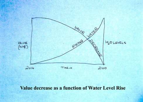

The sooner that a value-preservation solution is completed, the more likely it is to be worth the effort. Ultimately, it is too early to discard any options, and too late to delay any further.
Vernon Woodworth is a code consultant at AKF Engineers and a member of the faculty at the Boston Architectural College. With two coauthors, he wrote an opinion piece for CommonWealth on the Metro Boston Dikelands project.

CommonWealth Voices is sponsored by The Boston Foundation.
The Boston Foundation is deeply committed to civic leadership, and essential to our work is the exchange of informed opinions. We are proud to partner on a platform that engages such a broad range of demographic and ideological viewpoints.